
Smaller Boxes GPS
Longitude and latitude puzzle mechanics

I had been aware of GPS used in the context of geocaching, and as I have gotten more familiar with armchair treasure hunting I understand that many creators will use GPS numbers as fodder to encode in puzzles or maps. Hearing this recent conversation between the Cowlazars and One Clue Short hosts made me want to revisit the GPS area of thought. I feel like there are two GPS-related approaches that I can get behind with two of the smaller boxes. I want to see if I can organically discover (or force-fit, if needed) similar information in the other two boxes.
I still consider myself extremely new (a novice) when it comes to treasure hunting. After being introduced to TTI, I started to build understanding on other hunts that preceded this one. First I tried to find out more about the original Forrest Fenn (The Thrill of the Chase) hunt. I soon after learned about The Secret, Masquerade, and Breakfast Tea & Bourbon, among others.
I’ve been the most fascinated by The Secret given its multiple-hidden-item design and the puzzles/clues being hidden in paintings and poems/verse. My understanding is that at least 2 of the 12 paintings had some GPS information concealed that leads to the likely general areas of the treasure “casques.” As an example, for the Cleveland treasure which was found there were some years etched on one of the features in the painting.
If you take the first two numbers in reverse (41, 81) or second two numbers (42, 81) in order put you in the area of Cleveland though not necessarily the precise park location where the casque was found). You can learn more (and from folks who know more) about these on various sites (here is another example).
In There’s Treasure Inside, I feel like there is a strong, defensible case where some numbers could represent parts of GPS coordinates and then another bit of information confirms it.
Past & Future Box
In the word search, the numbers that are horizontal and reversed include three, nine, twelve, and zero. These could be arranged as 39, 120. The words "north” and “west” also appear horizontal and reversed. 39N and 120W
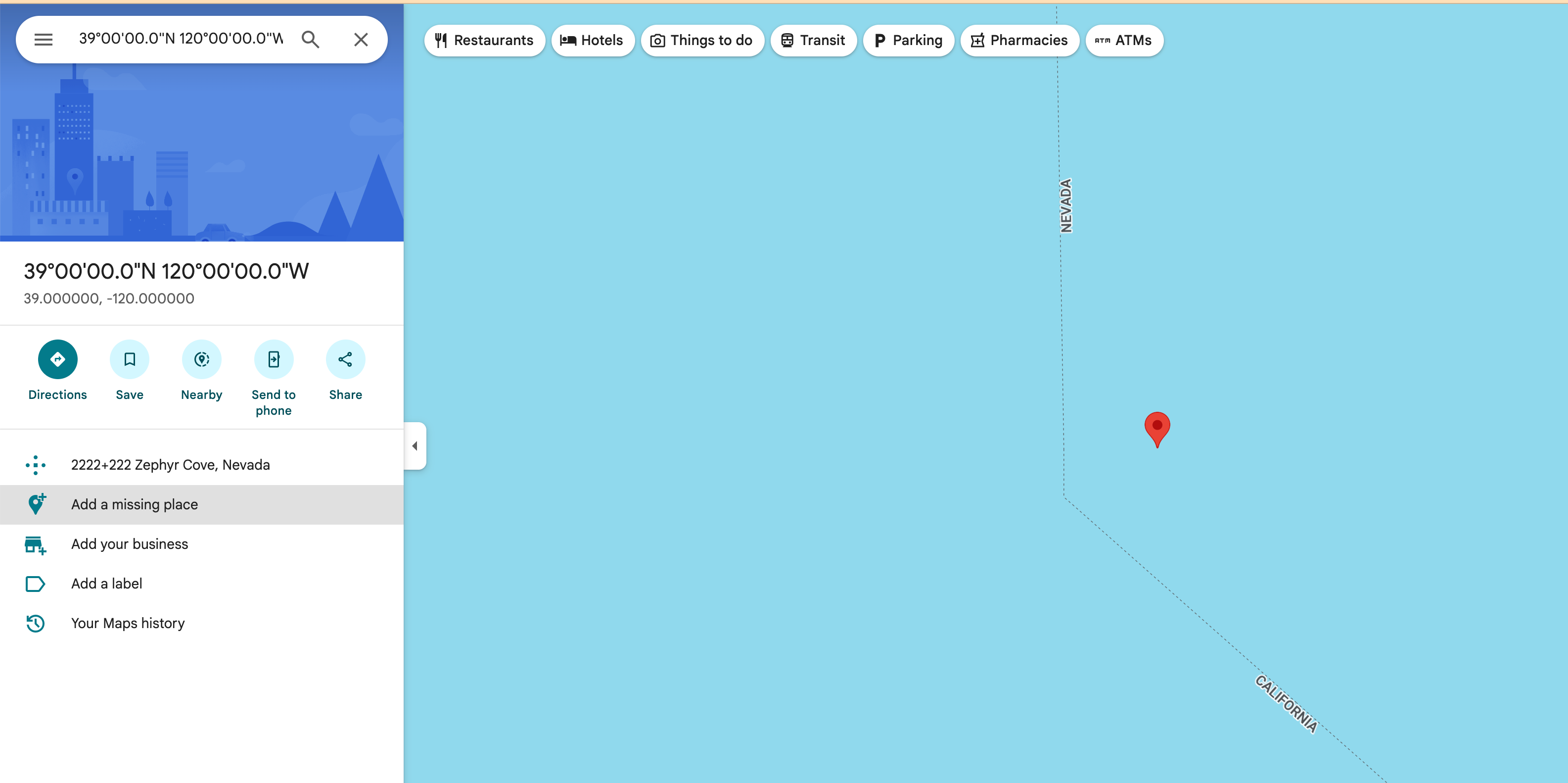
While at a different angle, this particular bend at the state border in the middle of Lake Tahoe appears very close to the angle shown on the P&F commemorative coin.
This is still very compelling to me.
Appalachian Footpath
The numbers 44 and 72-71 appear, as does potentially N and W on the map. This longitude and latitude area takes you to New Hampshire and an area that includes the White Mountains.
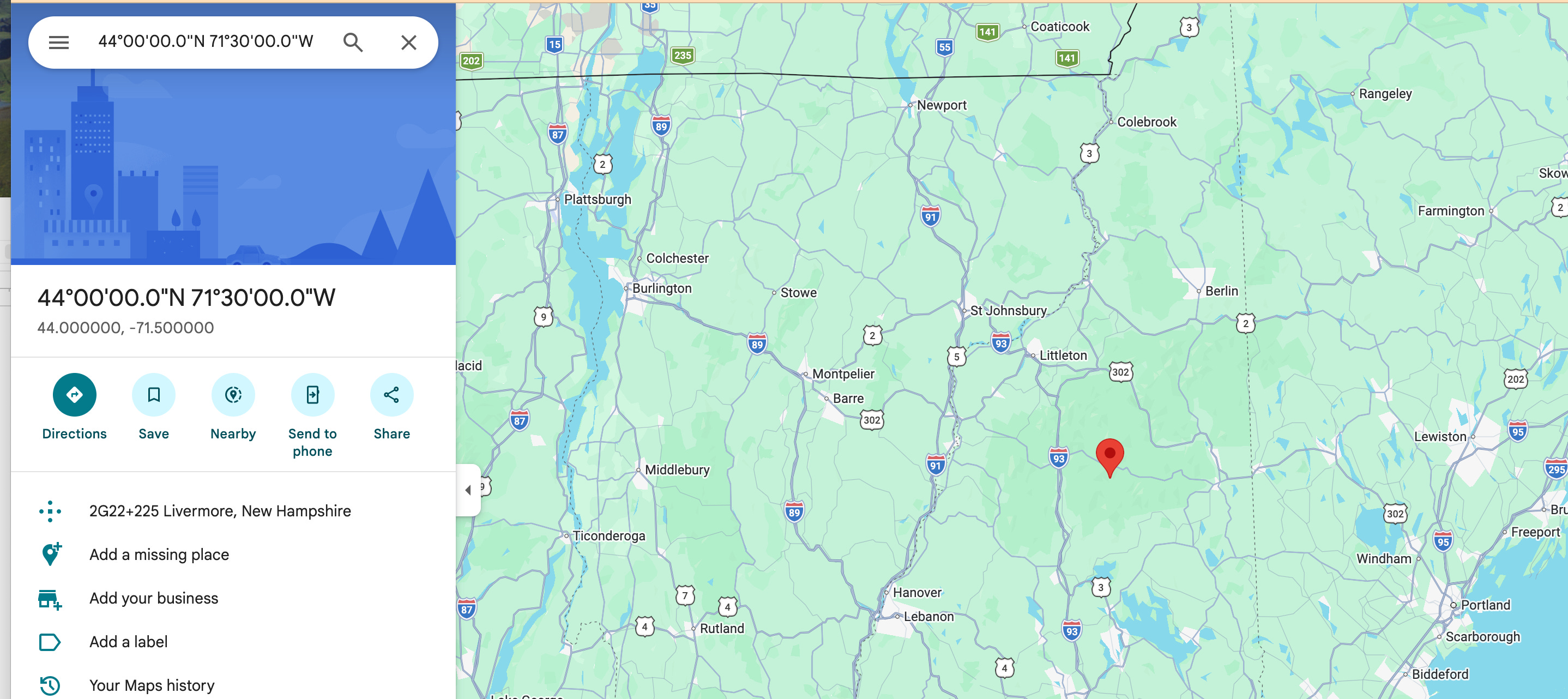
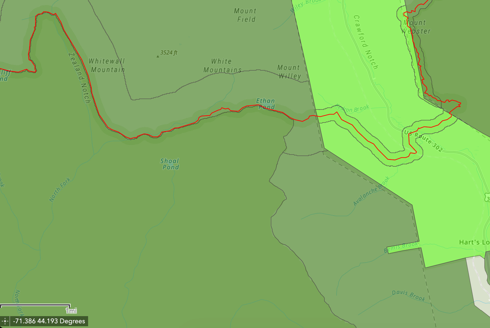
Within that area is a section of trail along the PResidential Range that aligns, to a degree, closely to the trail shape of the Little Rock Pond-matching dashed line.
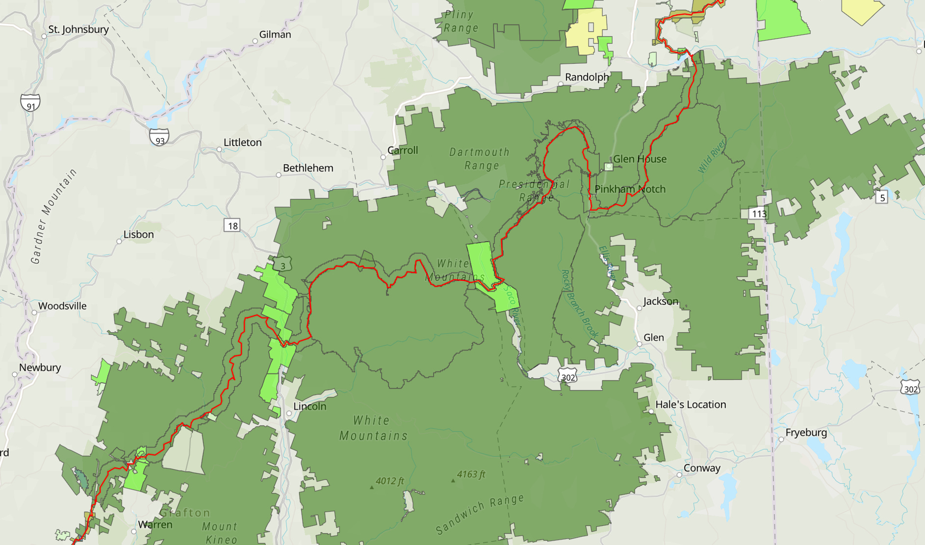
I’ve also taken the N1938 and worked it into the 44 to settle on an even more precise area (44.1938N). And I continue to like the very geometric/angular nature of Crawford Notch State Park.
So this may not be as strong as the P&F coin + horizontal-reverse numbers, but I think it’s still defensible.
Forrest Fenn
Based on some very rough searching for longitude and latitude maps, it would seem that the “Fenn State” search area of the Rocky Mountains is somewhere between 35 and 45N and 105 and 115W
There are no overt numbers in the TTI Forrest Fenn Box poem (at least that I see). I counted up the number of words in the poem and it was something like 164. However, if leave out the first and final stanzas (which mirrors what ended up needed for the “clue” portion of the original poem), there are 108 words.
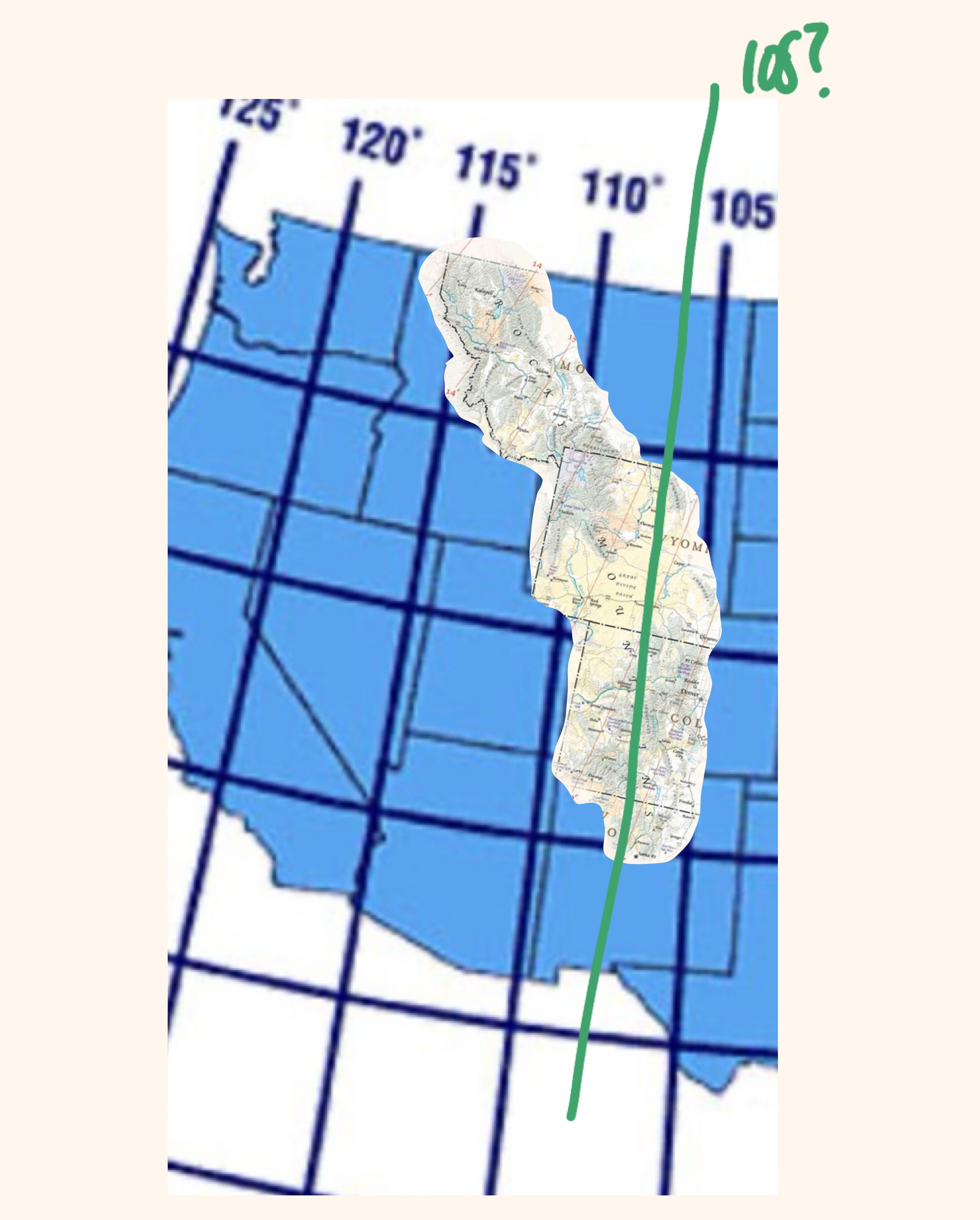
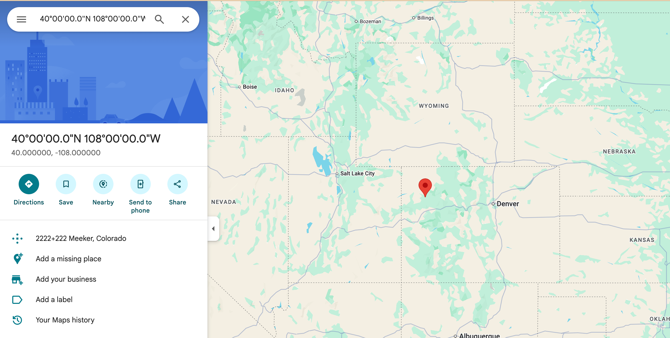
That gets you to this longitudinal area (very convenient for a CO solve!). Just like the AT box, you really only need one of the long or lat coordinates because the region has been defined along an area that is essentially a diagonal line. A vertical or horizontal line would intersect with a line with a non-zero slope at exactly one point.
Pokémon Box
There are a lot of things that can be worked or converted into numbers in this chapter. Anything I do will be a stretch. But what if the description of it being a sweltering day means that it’s 90+ degrees out. That would mean that the longitudinal area is somewhere between 90W and 100W, and overlapping the circular journey area.
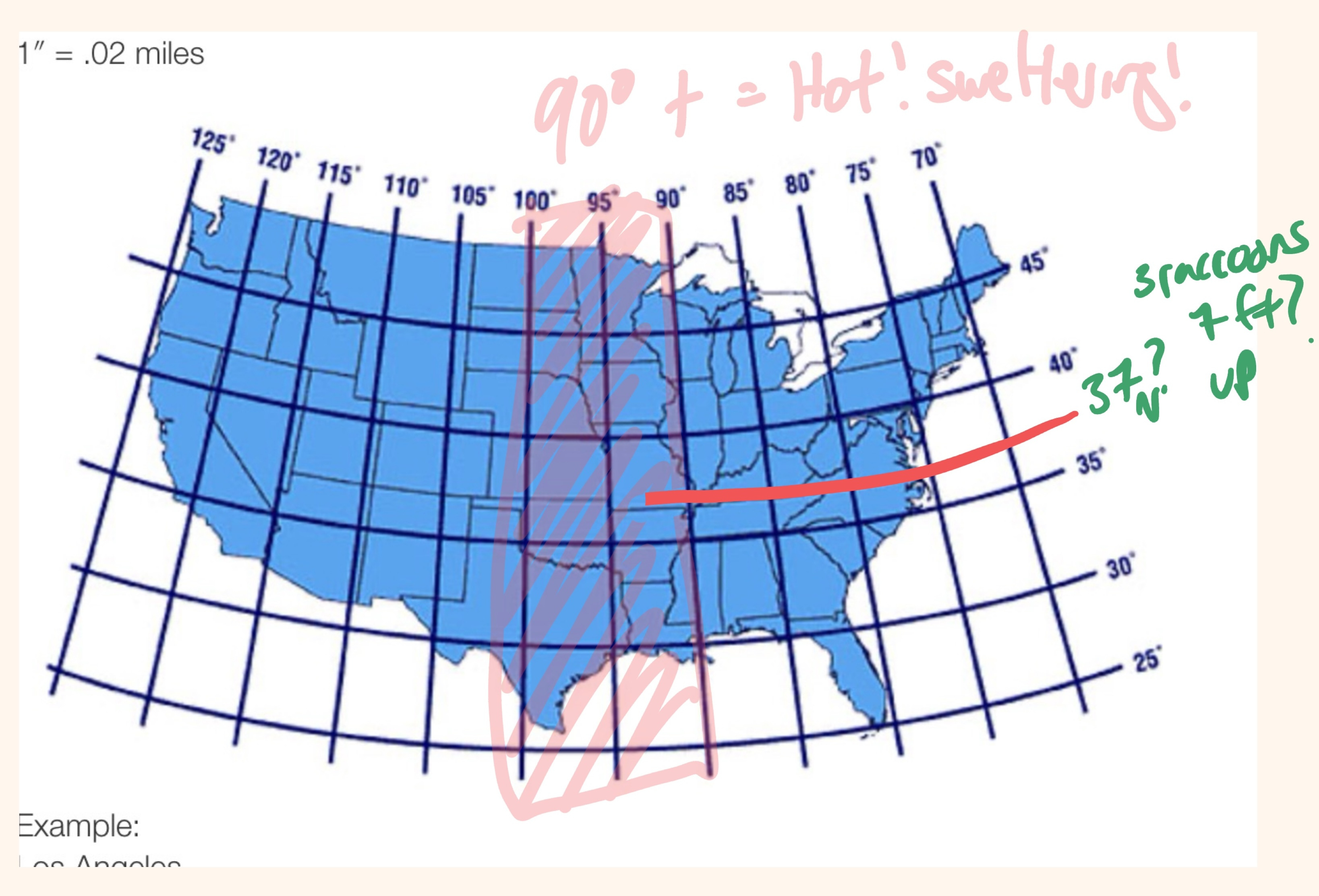
What if the raccoons and oak tree (3 animals, 7 feet) is 37 N (up)?
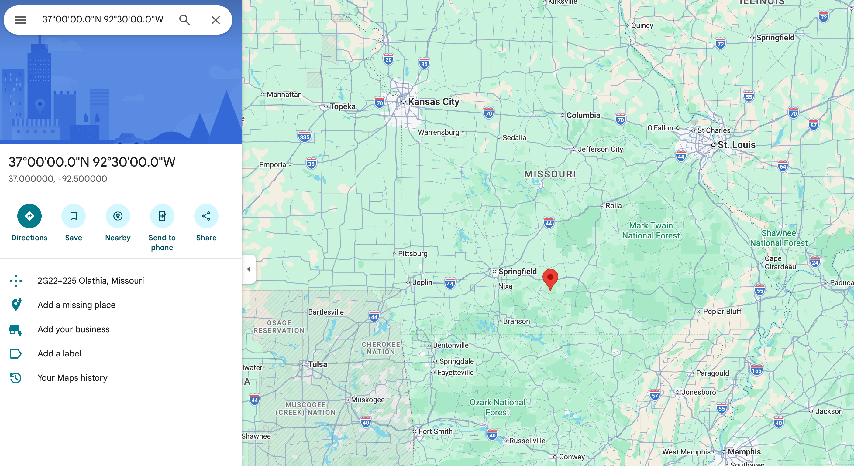
That puts us somewhere in Missouri (it is “past the Ozarks” if you were heading that way from Houston, TX.
I will continue to look for possible GPS connections in these last two chapters especially. It just seems like a treasure-hunt appropriate and easily satisfying clue. I think many people (including myself) would be ok with there being some creativity used to find some specific coordinates, even if brute force is what ultimately gets you there.
Love this! Interesting, I came up with Crawford Notch using numbers as well. But with different numbers in a completely different way. 🤯
I like it. In the original fenn poem, the line not far, but too far to walk is a hidden gps coordinate, imo. Begins with N, includes a common denoting the separation between latitude and longitude and ends with W. and of course, the words not, far and too/to are homophones.