
More Dashed Path
Appalachian Footpath Box Map

I continue to wonder if the dashed line on the Appalachian Footpath Box map in Chapter XXVII is meant to be a precise trail match, a gestural form for some trail or region, or (least likely for me) a broad area. I have a couple of ideas for each, some of which I’ve found myself and others that I have seen discussed online.
Note to readers: Friday posts moving forward (at least in the near term) will be available to everyone. Subscribers will continue to have full access to all posts, archives, and comments.
Broad Areas
I don’t really think that the dashed line is meant to be an outline or indicator of some large area (like a county or state), but I have seen some conversation about where the bend occurs resembles the lower peninsula of Michigan. This also kind of resembles a mitten. Additionally, there seems to be some historical and/or ongoing online debate (not in this treasure hunt necessarily) about which state looks more like a mitten: Wisconsin or Michigan’s LP.
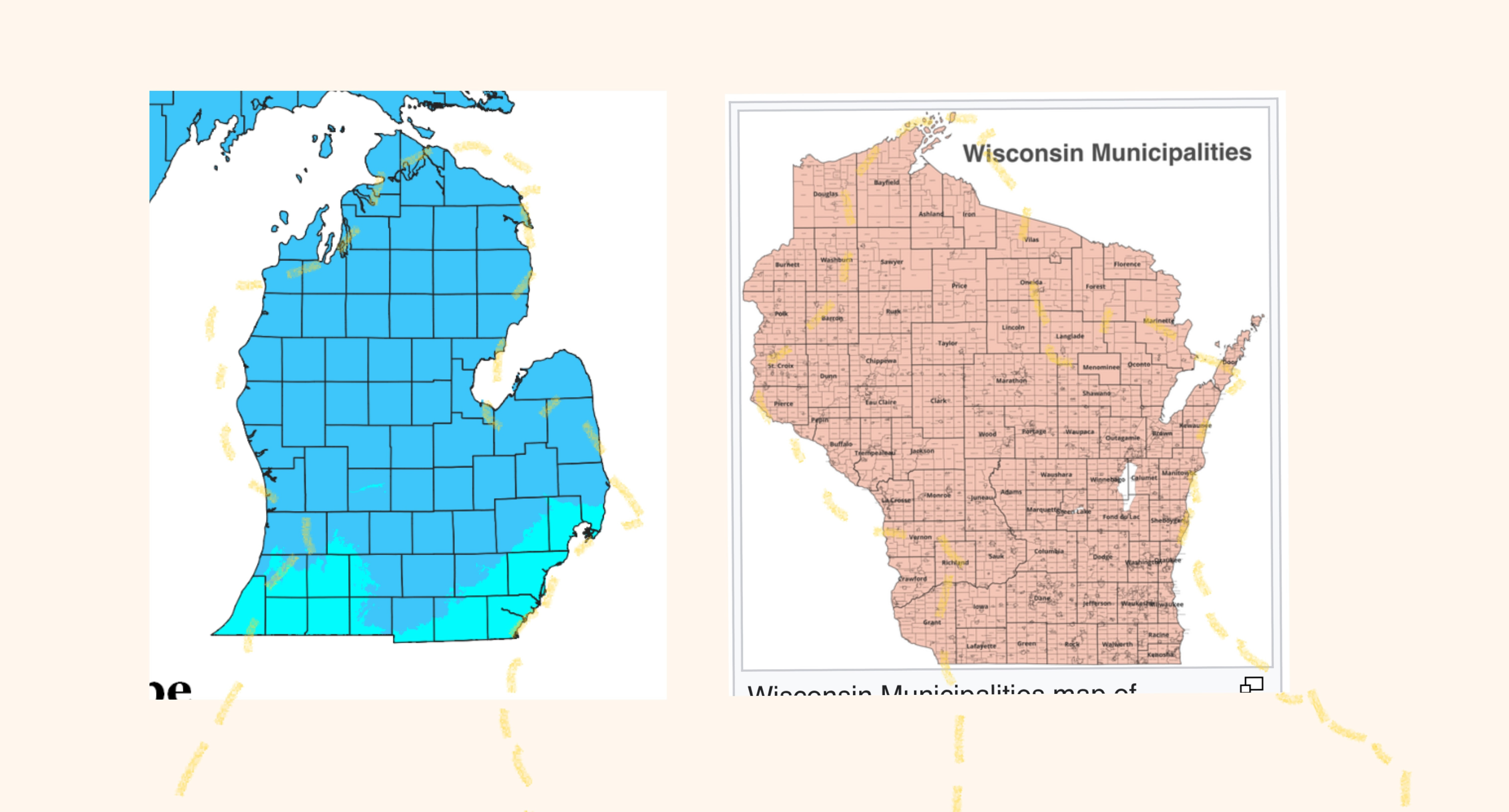
I had to rotate and flip the dashed line in order to make the path sort of align to the state. I don’t think this is a productive approach, but I think it’s worth at least acknowledging.
Gestural Form
Both of these are things that I came across during my focused digging on the AT box, and I still have not necessarily seen much discussion about either area online. That simultaneously makes me doubtful of the thinking and optimistic that I may have a unique and valid angle.
Presidential Range - White Mountains
The solve direction that I am still confident about and plan to return to during the window of time when there is less ground cover, fewer bugs, and not as hot, is in the White Mountains of New Hampshire.
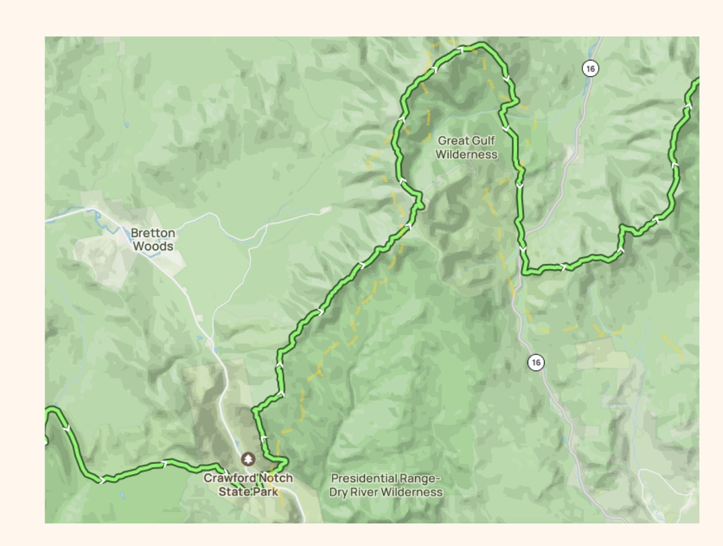
With the path rotated, it can line up similarly to the Appalachian Trail as it cuts through the Presidential Range (including Mount Washington). My points of great interest exist in Crawford Notch State Park (many mythological, magical, and Thoreau-ian references within). That park also has some interesting borders and edges that sync up with the black triangles.
Blue Ridge Parkway (NC)
While this area of this ‘famous’ road is close to Asheville, NC, it’s quite a bit south of the Appalachian Trail at this point of North Carolina (you can see the “High Point” of the east coast in Mt. Mitchell.
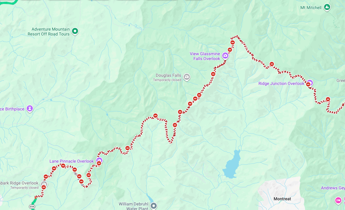
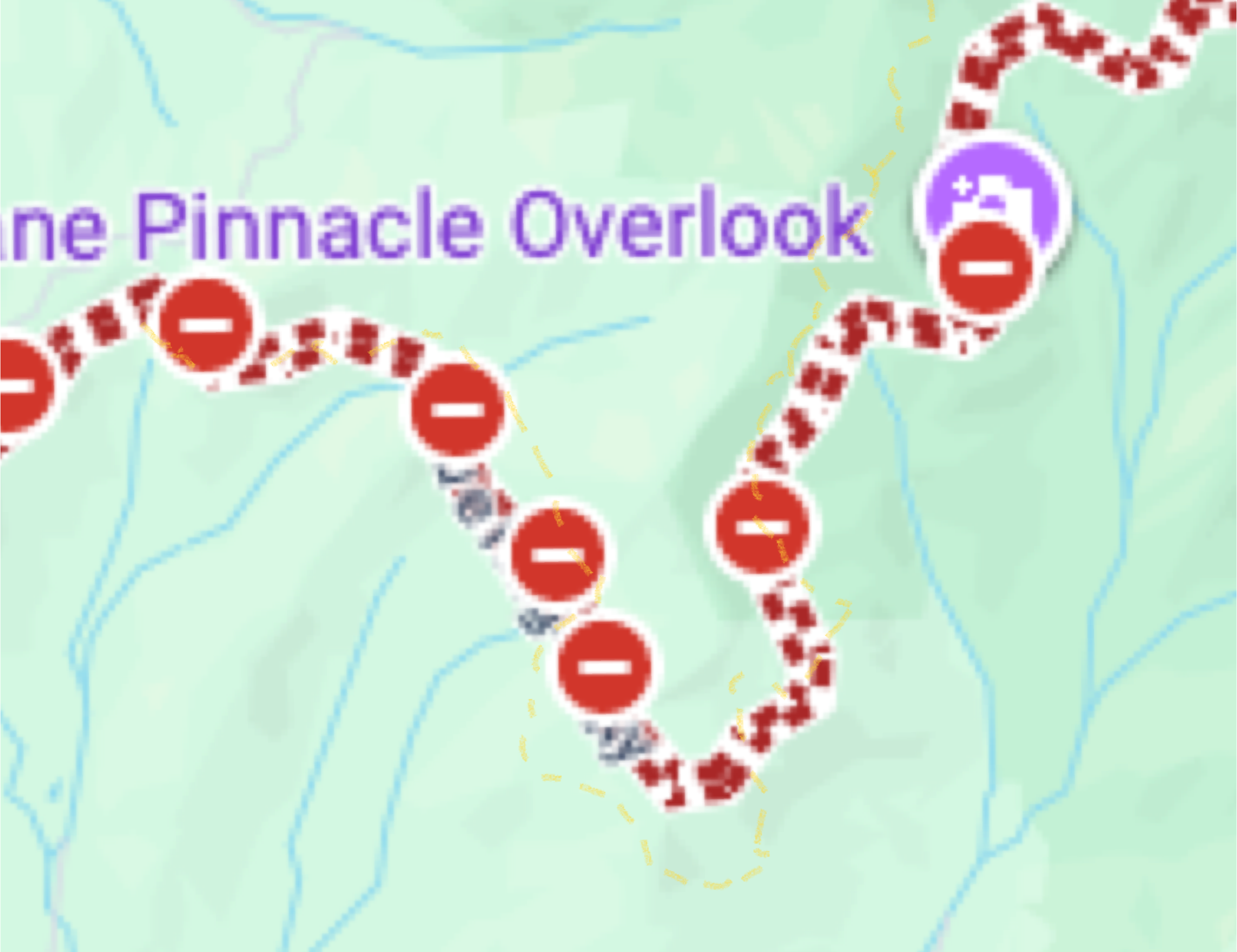
This area of the parkway also can be seen to follow the gesture of the map - and this time more or less in its original position as seen in the book.
Precise Trail Matches
The online community of treasure hunters is what drew my attention to these regions quite early in the hunt.
Little Rock Pond, VT

There is no denying how closely the trail matches along the western edge of the pond that continues up and around towards “Green Mountain”. With the peak and the triangle being in similar positions, as well as “1727” being an accessible elevation in feet in the area, it’s compelling that this was intended to be discovered. Whether it’s a clue to a larger solve or an “obvious” location, only time will tell.
Harriman State Park - Seven Hills Trail
In the southern section of Harriman State Park in NY (which the AT traverses), is another mitten-looking trail that resembles the dashed line when flipped.
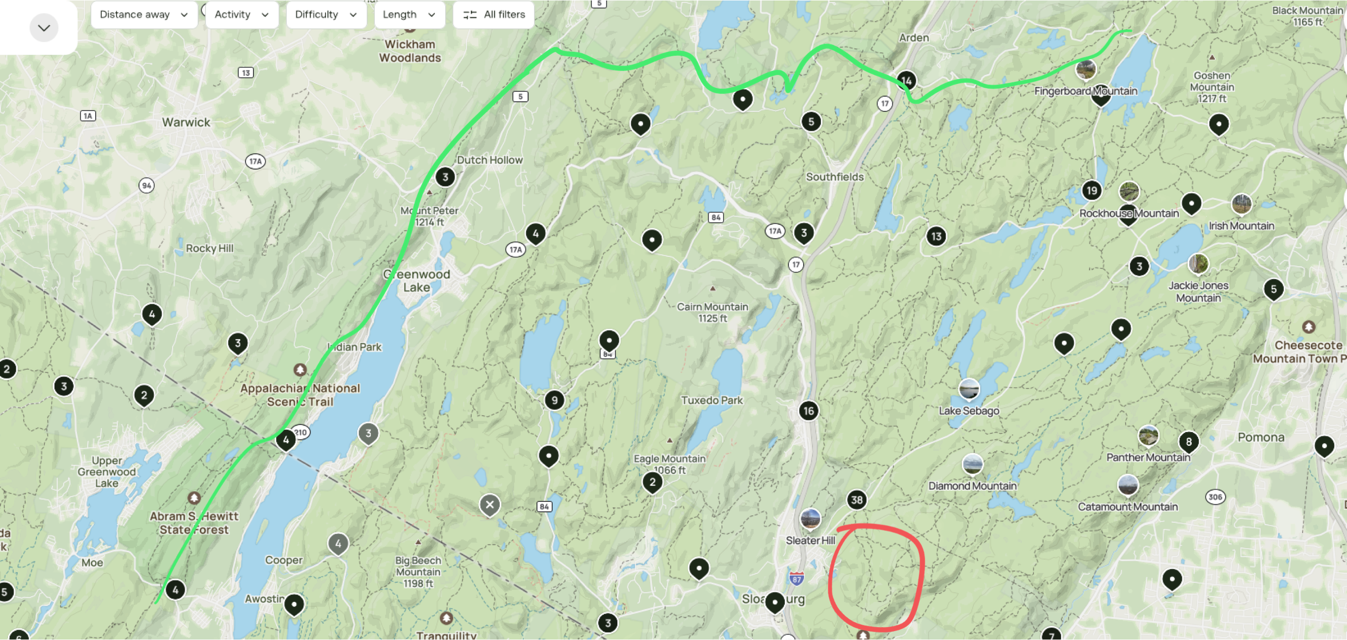
Is this “along” the AT enough to be a search area? Or perhaps it’s a marker for where to “BEGIN”. There are a lot of trails, peaks, lakes, and landmarks that one can associate with aspects of the chapter narrative and/or features of the map (Catamount Mountain, Bear Mountain, Sapphire Trail, Diamond Mountain). Even though it is quite close to the New York City metropolitan area, it is not necessarily a crowded or overused park, at least not along many of the deeper trails further from parking lots and picnic areas.
My preferred interpretation (biased, because it works for me) is the gestural form. But I am also fully supportive of any ideas that use the Little Rock Pond area match either as a clue (i.e. leading to something else) or as a location (obvious, yes, but it still hasn’t been found!).